The Waikato River is the longest river in New Zealand
FromLake Taupo, northwest to the Tasman Sea .


My father and brother, Beni, drove up toHamilton
Also, some rugged areas with steep climbs...
and challenging bush to get through.
D.O.C. huts (Dept of Conservation) are found in many areas of the country;
From


My father and brother, Beni, drove up to
the New Year with us. Doing a long distance hike with family close by is a
welcomed benefit. In this picture, (at the trail head on Jan 1, 2013), there are 3 generations of Paroli’s.
Rolling hills and farm land of “King Country”
Also, some rugged areas with steep climbs...
and are a welcome site for the weary hiker, especially when the weather is
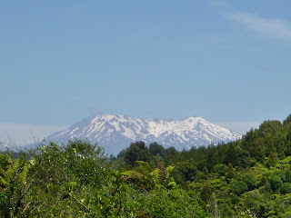
Looking east towards
It is an the largest active volcano in New Zealand, and last erupted on September 25, 2007.
Looking at Mt. Ngauruhoe in center and Mt. Tongariro to the left
(flatter looking mountain).
New Zealand sits on “The rim of fire”, and has many fault lines running throughout the country.
Deep valleys and gorges covered with native bush and vibrant rivers and streams.
Question: New Zealand
State in the USA
In upcoming blogs, I will summarize the first 1,000 km’s, (600 miles), of our hike through the country, and will highlight the “Gear” that we carry in our back packs (which has gone through some transformation).
Also, I will share 2 short stories of incredible coincidences that we will never forget.


No comments:
Post a Comment